
Giriş Yap
The Revolution of Satellite Technology: From Spies to the Masses
Temel Kavramlar
Satellite technology has evolved from a tool for government spies to a resource accessible to the general public, driven by advancements in AI and machine learning. The author argues that large language models will democratize satellite data analysis, making it available to anyone with an internet connection.
Özet
Satellites have transitioned from Cold War espionage tools to commercial assets, with over 8,000 active satellites orbiting Earth. Private enterprises now use satellite imagery for various purposes, including tracking wildfires and monitoring forest cover. The integration of AI tools like Meta's Segment Anything Model is revolutionizing satellite data analysis by automating object identification in images. Large language models like OpenAI's ChatGPT are poised to enable ordinary individuals to query satellite data akin to database searches. This shift towards democratization of satellite intelligence signifies a significant transformation in accessibility and usability.
The Open Sky
İstatistikler
There are currently more than 8,000 active satellites in orbit.
The U.S. government dropped its limit on legal commercial image resolution from 50 centimeters to 25 in 2014.
In August 2022, the limit was further reduced to 16 centimeters.
Objects as small as ten inches became visible under the new regulation.
U.S. spy satellites may capture objects as small as four inches or even smaller.
Alıntılar
"Large language models will democratize satellite data analysis, making it available to anyone with an internet connection."
"Private enterprises now use satellite imagery for various purposes, including tracking wildfires and monitoring forest cover."
Önemli Bilgiler Şuradan Elde Edildi
by Lars... : www.thenewatlantis.com 02-26-2024
https://www.thenewatlantis.com/publications/the-open-sky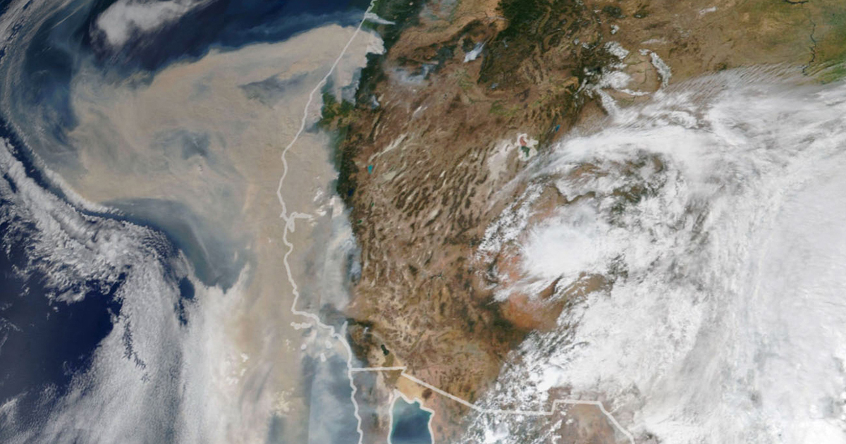
Daha Derin Sorular
How might the widespread availability of satellite intelligence impact privacy concerns globally?
The widespread availability of satellite intelligence could significantly impact privacy concerns globally by raising questions about surveillance and data collection. With more accessible satellite imagery, individuals may find themselves under constant observation without their knowledge or consent. This could lead to potential violations of personal privacy, as satellites can capture detailed images of people's activities and locations from space. Governments, corporations, or even malicious actors could misuse this information for various purposes, including tracking individuals' movements, monitoring private property, or conducting unauthorized surveillance.
What ethical considerations should be taken into account regarding the democratization of satellite data access?
Several ethical considerations must be taken into account regarding the democratization of satellite data access. Firstly, there is a need to ensure that individuals' rights to privacy are protected when using satellite imagery for commercial or personal purposes. Transparency in how satellite data is collected, stored, and used is crucial to maintaining ethical standards. Additionally, issues related to consent and informed decision-making should be addressed when accessing and sharing satellite imagery.
Moreover, it is essential to consider the potential implications of using AI algorithms on satellite data interpretation ethically. Ensuring fairness in algorithmic decision-making processes and preventing biases in image analysis are critical ethical challenges that need attention. Lastly, promoting responsible use of satellite technology to benefit society while minimizing harm should be a guiding principle in the democratization of satellite data access.
How can advancements in AI and machine learning enhance disaster response efforts using satellite technology?
Advancements in AI and machine learning have the potential to revolutionize disaster response efforts utilizing satellite technology by enabling faster and more accurate analysis of large volumes of imaging data during emergencies. Machine learning algorithms can automate image interpretation tasks that were previously done manually by analysts quickly identifying affected areas after disasters such as wildfires or floods.
These technologies can also improve predictive capabilities by analyzing historical patterns captured through satellites to forecast future disasters accurately. By integrating AI-powered tools with real-time monitoring systems based on high-resolution images from satellites like Landsat or Planet Labs', emergency responders can make better-informed decisions promptly during crises.
Furthermore, AI-driven models like ChatGPT enable users without specialized training to query specific information from vast amounts of available Earth observation datasets rapidly—facilitating efficient coordination among response teams during disaster situations.
0
Bu Sayfayı Görselleştir
Tespit Edilemeyen AI ile Oluştur
Başka Bir Dile Çevir
Akademik Arama
Hakkında
Ürünler | Kaynaklar
© 2024 by Linnk AI